Thursday, 5 June 2014

100 not out

I finished off the week and the month by making it to 100 streets photographed. I started from Aldgate tube station one morning, with time to spare before going to work. First stop was St. Botolph Street, where St. Botolph's Church is located - one of the four medieval London churches dedicated to the saint. This is not a picture of the church, rather the exit of an unnamed alley that run to Aldgate High Street.


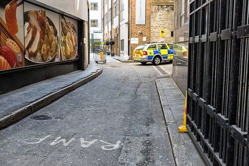
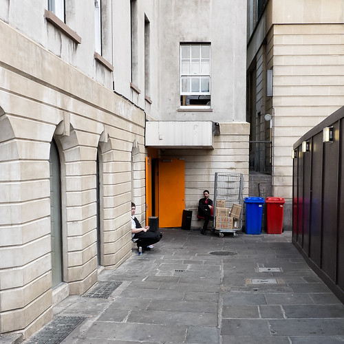
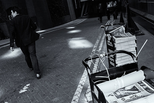
Heading towards work, the next stop was Stoney Lane, to take a rather bad photograph, which has not been saved by the conversion to black and white.


Stoney Lane leads from Houndsditch to White Kennett Street, where I came across a traffic warden about to give someone a ticket.

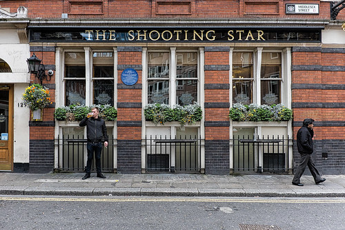
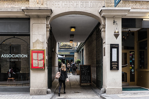
Next up, and round the corner is Harrow Place, where I saw this great sign.


Last stop before work was Houndsditch and I was immediately drawn to this scene. This used to be a Starbucks and its almost nice to see one has closed down, for some reason.


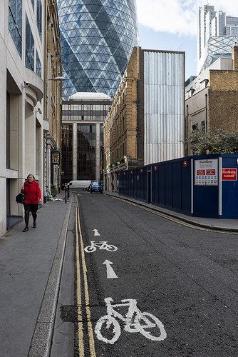
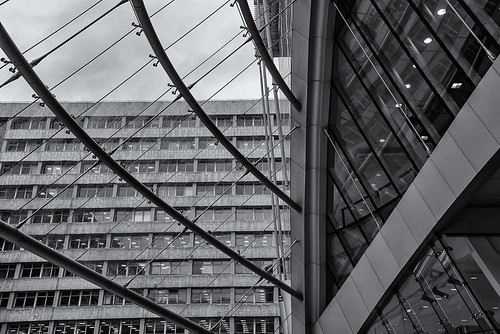
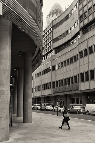
The same evening I managed a few more shots, filling in more of this area between Bishopsgate and Aldgate.  Undershaft is just off St. Mary Axe and the Gherkin can be clearly seen in the background. The building on the left is where I worked when first in the City back in 1998. I remember watching progress of the Gherkin being built. day by day, and remember the whole office gently vibrating constantly when they were digging the foundations.


To the right of the Gherkin is a small Alley/Lane called Brown's Buildings, a small section of which is covered by a  building overhead; its not clear if Brown's Buildings refers to just the covered bit or the whole lane/alley.


There are two straight streets that are parallel and very close to each other, running from Bishopsgate to Aldgate High Street. One is Houndsditch. The other starts off as Camomile Street (see previous blog entry) before turning into Beavis Marks and then finally into Dukes Place. The following picture is of Beavis Marks, which is probably most known for its synagogue, which is the oldest in Britain. Photographing that would be obvious though, wouldn't it?


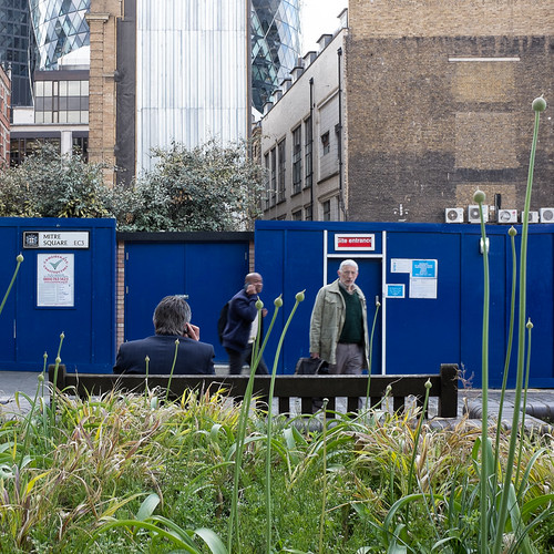
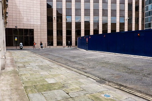
My last shot of the month is of Creechurch Place. I had photographed Creechurch Lane before, not realising (thanks to Google maps) that as it goes round a bend, the road changes name. That is one thing I have to look out for, as well as many smaller streets and alleys that are not on Google Maps at all. Anyway the month was finished off with a rather poor effort, but there really wasn't much to photograph.


Finally to finish with, the updated maps showing my progress.


Wednesday, 28 May 2014

Lacking Inspiration

I have struggling a bit with bronchitis the last few weeks so I have been feeling quite run down. As a result I have been lacking both inspiration and motivation, but I had to keep shooting to stay on track.

All my photography time the last week was spent mostly between work (Old Broad Street) and Aldgate. I started off at Devonshire Square which I referenced in a picture of Devonshire Row last week. The picture below doesn't actually show the square itself but the road coming off the square, and which shares the same name. The office in the background is occupied by the Royal Bank of Scotland.


Down from Devonshire Row, just off Harrow Place is Artizan Street, where the Middlesex Street Estate starts.


At the opposite end of the the estate is Gravel Lane, and here I photographed one of the shops on the ground floor of the estate building; I don't think I have ever seen so many hats in one place before.


The following morning I made it into the City about 8:30, so had a bit of time to take some photos, but the rain dampened my enthusiasm a little and I only managed to tick off two streets.I started off at Alderman's Walk, which I had thought I had photographed last week, but hadn't.


Before heading into the office I popped over to Threadneedle Walk, which connects Throgmorton Street with Old Broad Street. The sculpture at the Old Broad Street end, shown below, is called "The City Wing" and is by the president of the Royal Academy of Arts, Christopher Le Brun. It was erected in 2009 and is 10 metres tall.


Later, after work, I managed a couple more shots. The first is from Camomile Street, though it might seem like its from Bishopsgate. 100 Bishopsgate is one of the many new office blocks currently being developed in the City, on the corner of Bishopsgate and Camomile Street. Its construction looks like it is going to remove at least two streets from the map; Clerks Place and Wrestlers Court.


Close by, between Houndsditch and Devonshire Square is Barbon Alley. This is likely named after Nicholas Barbon, who was a MP, property developer and insurance magnate amongst other things. He developed many areas of the city after the Great Fire, ignoring statute and using strong arm tactics to do so, demolishing many buildings without permission in the process. An odd and interesting fact is that his middle name was "Unless-Jesus-Christ-Had-Died-For-Thee-Thou-Hadst-Been-Damned".


Saturday, 24 May 2014

Around Moorgate again

I had a few streets to left to photograph on the South Side of Moorgate and ticked them all off this week.
At the side of the station is Moor Place, where a plaque commemorates  the fourty three people who died at the station in 1975, when a train failed to stop and crashed into the wall at the end of the Tunnel. There is also a memorial close by at Finsbrury Square. The accident led to the introduction of safety systems which automatically stops a train if the driver fails to brake, which became informally known as  "Moorgate Protection". Hundreds it not thousands of people walk out of the station and past here every day, and this picture made me wonder how many are oblivious to the tragic event that happened beneath their feet.


Apologies for the sombre start. This was on my way to work in the morning and I crossed Moorgate and headed down South Place, which I had walked down several times before during this project. Previously I had photographed the end closest to Liverpool Street, not realising that it changed name half way. In the picture below, South Place turns into Eldon Street where the Red Lion pub is.


To the side of South Place is South Place Mews, a small street made even smaller due to development and with not much to photograph.


The same evening I walked back towards Moorgate station and photographed the two remaining streets I had missed between Copthall Avenue and Moorgate. First I went to Moorgate Place, where stands Chartered Accountants Hall, home to the Institute of Chartered Accountants, seen in the picture below.


The building was completed in 1893. In 1959, the building was extended with five stories suspend above the great hall, and a second facade on Copthall Avenue, built in a mixture of concrete and glass. The picture below is taken from Langthorn Court a small side street off the avenue, which show that blending of concrete and glass.


That's it for this week. Another short week next week due to a a bank holiday on Monday.

Wednesday, 21 May 2014

More from around Liverpool Street and Bishopsgate

This week I wanted to fill in the area surrounding Liverpool Street and that end of Bishopsgate and this area is now almost complete.

Starting off with Liverpool Street itself. About half of Liverpool Street is currently closed off due to work on Crossrail, but there is still a lot of interest including the station itself and the Andaz Hotel, originally  the Great Eastern Hotel built in 1884. However Instead I chose to shoot what I believe is an old and now closed entrance to the tube station (which I think would probably lead to the Circle/Metropolitan/Hammersmith and City Line).


On the right and behind here is White Hart Court. This yard would have been property of the White Hart pub which has been around since medieval times, but rebuilt in 1829.


Up the few steps (in the right of the picture) leads you to Alderman's Walk, of which there isn't really much to say, other than it leads from Bishopsgate to Old Broad Street. I though I had taken a picture of Alderman's court but I hadn't. The following picture is of White Hart Court again, to the left of the above picture, and showing a part of Bishopsgate.


The following picture actually is of a footpath that connect Alderman's walk to Bishopsgate Churchyard, and doesn't have a sign, so I guess it could be part of one or the other.


Talking of which, below is Bishopsgate Churchyard which attracts a lot of people at lunch time as it a nice quite and green place to relax, chat and eat. The churchyard is part of St. Botolph-without Bishopsgate. There has been a church on this site since medieval times and its position was just outside the city gates near the "Bishops Gate". The church narrowly escaped the Great Fire, but only due to the Sexton's house being demolished to stop the spread of fire.The current church was rebuilt in 1725 and completed three years later. I should probably take a picture of the church too.


Near the end of the Churchyard and also Alderman's walk is an entrance to Liverpool Street underground station, situated just inside "The Arcade". This perhaps should not be included here as it is not a street as such although is marked on the maps.


On the other side of Bishopsgate, I headed to Victoria Avenue which is at the side of the Bishopsgate City of London police station. I'm not sure how I missed this street previously as I photographed several streets either side of it, and behind it.


Then I moved on to Devonshire Row, which was originally a driveway for Devonshire House on Devonshire Square, built in the 16th Century.


Towards the top end of Devonshire Row, on the right hand side is all Cavendish Square, which is thought to have been a footpath for servants and the like from Devonshire House to use. There is currently some major development going on to the right of the picture, behind the board.


Sunday, 18 May 2014

Catching up

I didn't manage to take any pictures this week, as for various reasons I was only in London for one day. However I still have a few pictures from last week that I didn't get round to posting.

Starting off with Primrose Street, which I had been down twice before, but not photographed. This turned out to  be something I was glad of, as on this occasion I noticed an interesting building that I hadn't spotted before. Not only that,  but the sun was casting some fantastic shadows down on to the ground.


I then ventured down Bishopsgate and onto Middlesex Street , which runs all the way to Aldgate High Street. The famous Petticoat Lane market, actually consists of markets on two streets, Middlesex and Wentworth Street. This image is close to the Bishopsgate end and is of The Shooting Star Pub, which dates back to 1896.


Close by  there is a left fork in the road, which turns into Widegate Street.


Just before the junction with Sandys Row (where the red building is in the picture above), there is a tiny alley on the right called White Rose Court, which doesn't offer many photographic opportunities.


The City boundary follows Fort Street onto Sandy Row, before turning onto Middlesex Street. Located here is the  Sandy's Row Synagogue. The building was constructed in 1766, but has been a synagogue since 1857. I found a fantastic set of images relating to life here at Life at Sandy's Row Synagogue.


Just behind Middlesex Street is the fantastically named Catherine wheel Alley, small alley which becomes tiny about half way towards Bishopsgate. Its name comes from a pub the Catherine Wheel,which was demolished in 1911. Dick Turpin is alleged to have held meeting in this alley to plot his next hold up.  One of things that amuses me when going down some of these small alleys are the yellow lines; they are often so narrow that there really is no need for yellow lines on both sides, and at this part of Catherine Wheel Alley, you might just about be able to park a Smart car, but not without three of its sides being on yellow lines.


Near the Middlesex end of this alley is another, called Cock Hill.


Cock Hill leads to New Street. In the picture below, you can see the rear of the City of London Police Station, which is situated on Bishopsgate and one of only three stations in the force.


Just to the left of the station is Rose Alley which connects to Bishopsgate. However it is gated off to the public, so the picture below shows all that is accessible, and this limits photographic opportunities somewhat.


In the next few weeks I plan to fill in more of the streets between Liverpool Street and Aldgate, and also between Moorgate and Barbican.

Wednesday, 7 May 2014

Another Short Week

Another bank holiday meant it was another short week, but at least the tube strike was cancelled. One of my goals this week was to fill in a few of the streets that I had missed around the Liverpool Street area. Starting off with Finsbury Avenue, a small road leading to Finsbury Avenue Square (which I photographed in the first week or so of this project). Having passed this street a few times, I knew that there was a chance of a picture if the light was right, and on this particular day there were some great shadows, created by some trees.


I walked through Finsbury Avenue Square, along Appold Street and to Pindar Street, a small L shaped  that connects to Primrose Street, and also a tunnel that I think goes under/to Liverpool Street Station.


Primrose Street was also on my list this day, but I walked its length without remembering to take a picture, as I made my way towards E1 for the first time during this project, to Brushfield Street, of which only the first couple of hundred metres are within the City.


The boundary of the City turns off onto Fort Street, of which I could only access roughly the first 20 feet, as the remainder was closed off due to construction work. This left minimal photographic opportunities. The only building before all the boards was a hairdressers, and I was lucky enough to catch somebody coming down the stairs - I really like this picture.


As I couldn't go along Fort Street I made my way back to Bishopsgate and then down Artillery Lane. The sun was really strong and their was a huge difference in light between the lit and shaded parts of the street.


The same day, in the evening I walked to Moorgate determined to get a shot of Finsbury Circus.On the way I got this shot on Blomfield Street, though it doesn't really show any of the street.


The next day on the way home I decided to walk to Aldgate Tube Station and tick of some of the smaller streets on my way, starting off with Heneage Lane, off Beavis Marks. There is not a lot to this place, although on side is the wall of the synagogue on Beavis Marks. According to Synagogue Scribes, it was once called Lousy Lane.


At the end of the lane is Greenchurch Lane, where you can find the Old Tea Warehouse, a lovely pub that I used to frequent years ago when working on St. Mary Axe. The name comes from the fact that it used to be owned by the East India Tea Company.


Annoyingly I didn't realise that the L part of the lane (back towards Beavis Marks) actually changes into Greenchurch Place, so I will have to go back to this spot.  From here I made my way down to Mitre Street and Mitre Square, of which there is not much to say, and certainly not much to photograph in the latter case.


At this point I decided to put my camera away and head for home, However on Aldgate High Street I cam across a huge wooden structure,which turns out to be in commemoration to the streets most famous resident, Geoffrey Chaucer. More information can be found at Studio Weave.


Friday, 2 May 2014

Asking A Stranger Twice

One of the things I wanted to be achieve from this project, was to build up a bit of confidence in asking people if I could take their picture - well this week I asked two people and neither objected. Hooray. It was more a case of them happening to be in the picture rather than them being the picture, but I still  felt the need to ask, and had the confidence to do so.

I again decided to start my journey home from Moorgate and fill in a few of the streets around there. First up was Circus Place, which is just off London Wall and leads onto Finsbury Circus. This is the second time I have tried to get good shots of these two places and failed. Circus Place is a short street with not a lot on it, so this shot will have to do, but I will try again at Finsbury Circus another day.


Directly behind Moorgate is Moorfields. There is a lot of development near the station at the moment, and I spotted this construction worker in the closed up shop window; I was drawn to the colour of his gear matching that of the writing in the window.. He was my fist success, when asking if he minded me taking his picture,


At the north end of Moorfields is Ropemaker Street. The following picture is from under the porch of the CityPoint building, built in 1967 and renovated in 2000.


Further down Ropemaker street at the junction with Moor Lane and Milton Court, I took the following picture - nobody quite walked where I wanted them to, perhaps they thought they were getting in my picture.


Milton Court, is I think, a new street, houses a new building for the Guildhall School of Music and Drama, but that isn't what I photographed (though perhaps should have). Instead, I liked the reflections of the building seen here, and this lady was the second persons whom I asked if I could take her picture. She was very obliging and I told her a little about this project. The building in the reflection, is I believe the new Guildhall school of Music and Drama building mentioned above.


Round the corner is Moor Lane.


Still on Moor Lane, or at least above,  we come to the of the Barbican Centre and Willoughby Highwalk. I think there may be a lot of walkways in the Barbican, which probably don't count as as streets as such, but do count according to my definition given in an earlier post. I think it will be very interesting to explore the Barbican, so hope to include if further in the future.